
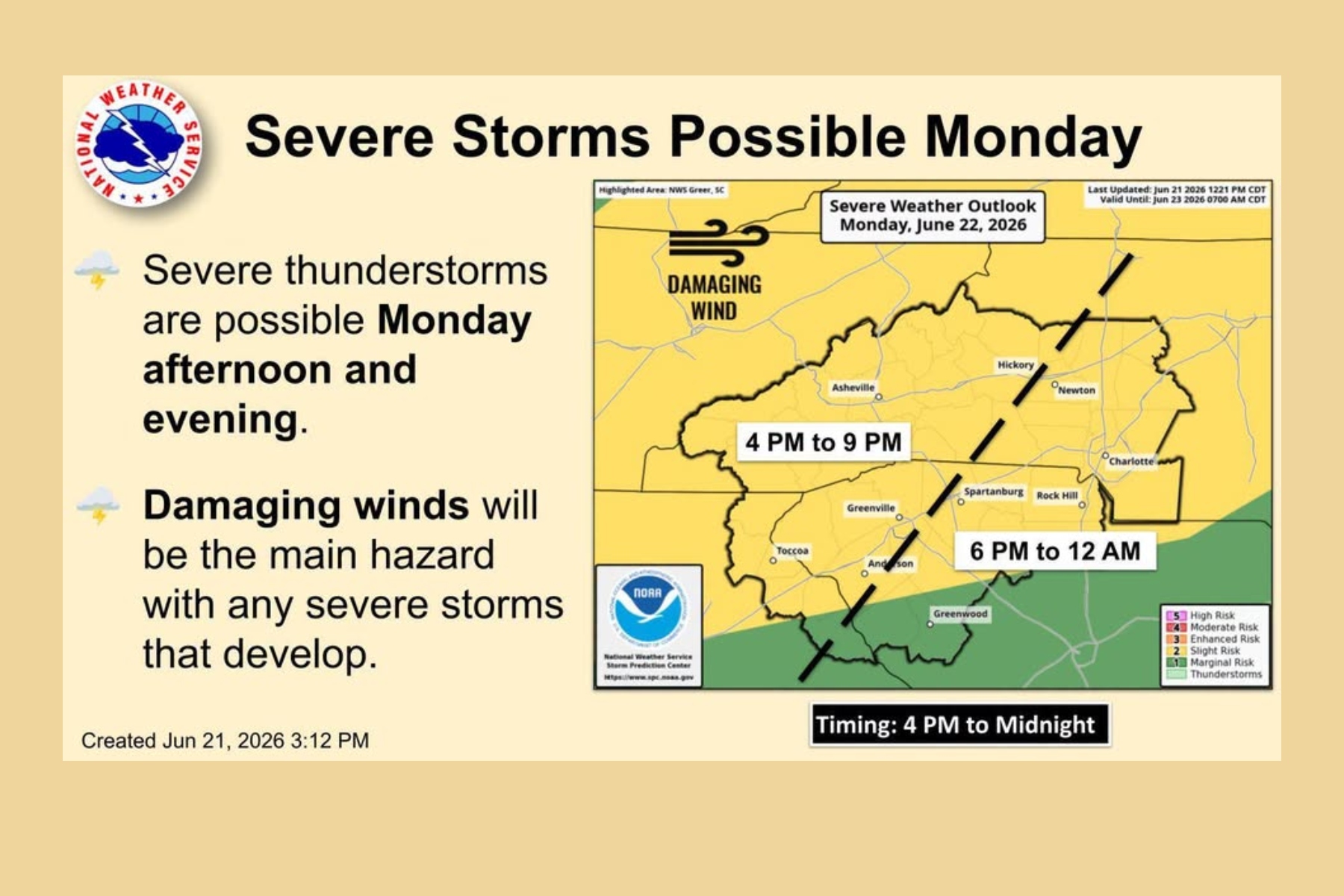
ASHEVILLE, N.C. (828newsNOW) — Western North Carolina could see strong to severe thunderstorms Monday afternoon and evening as a cold front moves through the region, according to the National Weather Service.
Forecasters with the National Weather Service office in Greenville-Spartanburg expanded a slight risk for severe weather to nearly the entire forecast area, which includes Western North Carolina, Upstate South Carolina and northeast Georgia.
The primary threat will be damaging straight-line winds, though heavy rain, frequent lightning and localized flooding are also possible with stronger storms.
Meteorologists expect scattered showers to develop during the day before a more organized line of thunderstorms forms ahead of the approaching cold front. The greatest threat for severe weather is expected between about 4 p.m. and midnight.
Forecasters say the mountains and areas along and north of Interstate 40 could see the highest risk for damaging wind gusts because storms are expected to strengthen during the hottest part of the day.
Outside of thunderstorms, breezy southwest winds could gust between 20 and 30 mph, especially east of the mountains.
For the Asheville area, showers and thunderstorms are likely Monday afternoon and evening. The high temperature is expected to reach around 87 degrees before storms move through the region. Some storms could produce brief heavy downpours and wind damage.
Most thunderstorm activity is expected to move out shortly after midnight, although a few showers could linger into early Tuesday morning.
Tuesday looks noticeably cooler, with a high near 80 degrees and only a slight chance of an afternoon shower. Drier weather is expected Wednesday as high pressure builds into the region.
The break will be short-lived.
Daily chances for afternoon and evening showers and thunderstorms are expected to return Thursday and continue into the weekend as warmer and more humid conditions settle back into the area.
By Sunday, temperatures outside the mountains could climb into the low to mid-90s, with heat index values topping 100 degrees in some locations across the Carolinas, according to the weather service.
Residents are encouraged to monitor forecasts throughout the day Monday and have multiple ways to receive weather warnings if severe storms develop.