ASHEVILLE, N.C. (828newsNOW) — Residents in parts of Western North Carolina woke to localized flooding Tuesday morning after heavy rainfall drenched the region overnight.
Broad River Fire & Rescue reported between 1.6 and 1.9 inches of rain since midnight. Some low-lying roads remain covered in standing water, officials said.
The National Weather Service in Greenville-Spartanburg warned that scattered to numerous showers and thunderstorms are expected through Tuesday night, with the potential for flash flooding at low-water crossings and in poorly drained urban areas. Conditions are expected to remain muggy through the week, with cooler but drier weather moving in by Monday.
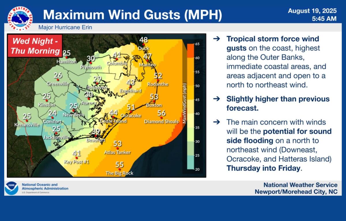
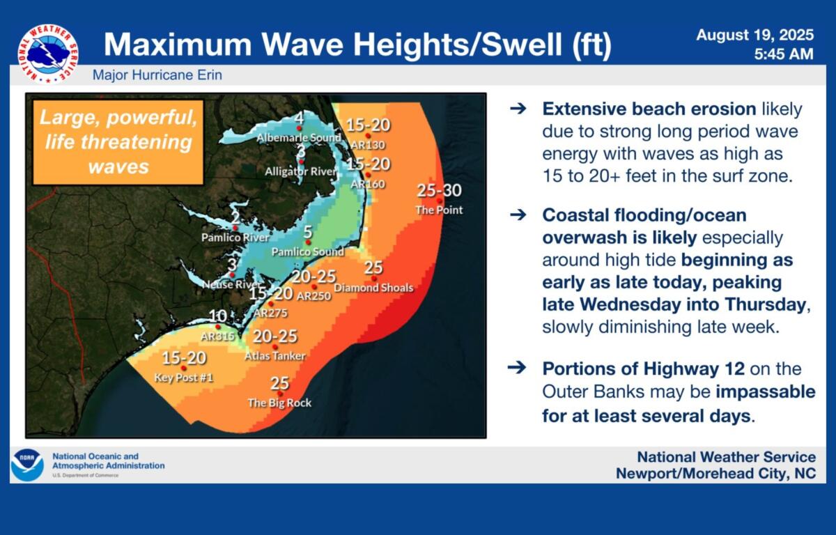
On the coast, forecasters are warning residents and visitors to stay out of the ocean as Hurricane Erin passes offshore. The National Weather Service offices in Newport and Wilmington said strong swells will bring life-threatening rip currents and dangerous surf conditions to the Carolinas through Friday. Tropical storm watches remain in effect for parts of the Outer Banks, where winds are expected to reach tropical storm strength.